Six Points Interchange and Kipling Mobility Hub
City of Toronto, Toronto Urban Design Awards, 2017
Royal Architectural Institute of Canada, National Urban Design Award, 2018
Consulting Engineers of Ontario, Award of Merit, 2018
Six Points Interchange and Kipling Mobility Hub
City of Toronto, Toronto Urban Design Awards, 2017
Royal Architectural Institute of Canada, National Urban Design Award, 2018
Consulting Engineers of Ontario, Award of Merit, 2018
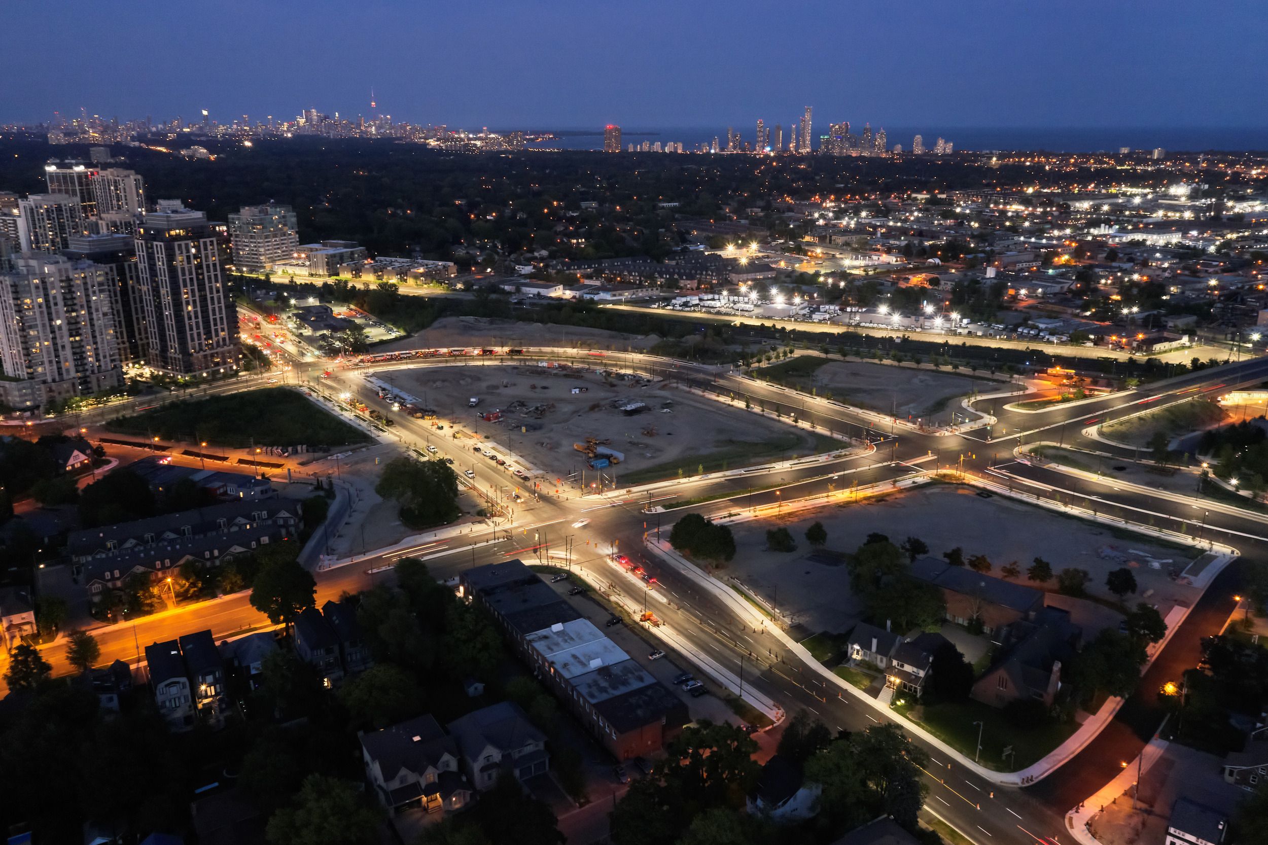
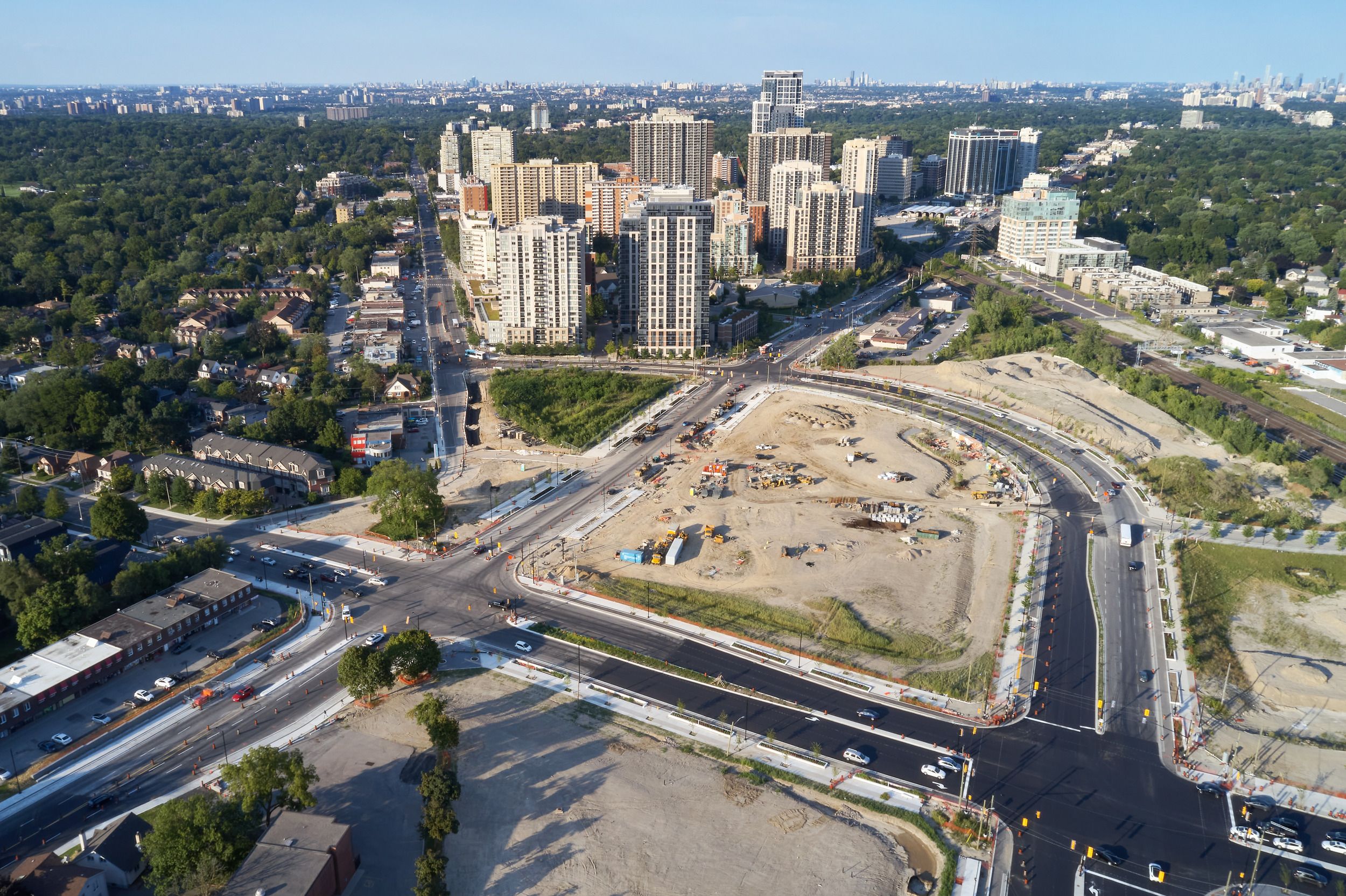
Sometimes the most powerful urban interventions involve undoing past mistakes. The Six Points Interchange was a car-focused, multi-tiered freeway junction that isolated surrounding neighbourhoods and created a concrete barrier at the convergence of Dundas Street West, Kipling Avenue, and Bloor Street West. Our vision replaced this infrastructure with three grade-related intersections where pedestrians, cyclists, and motorists can co-exist safely.
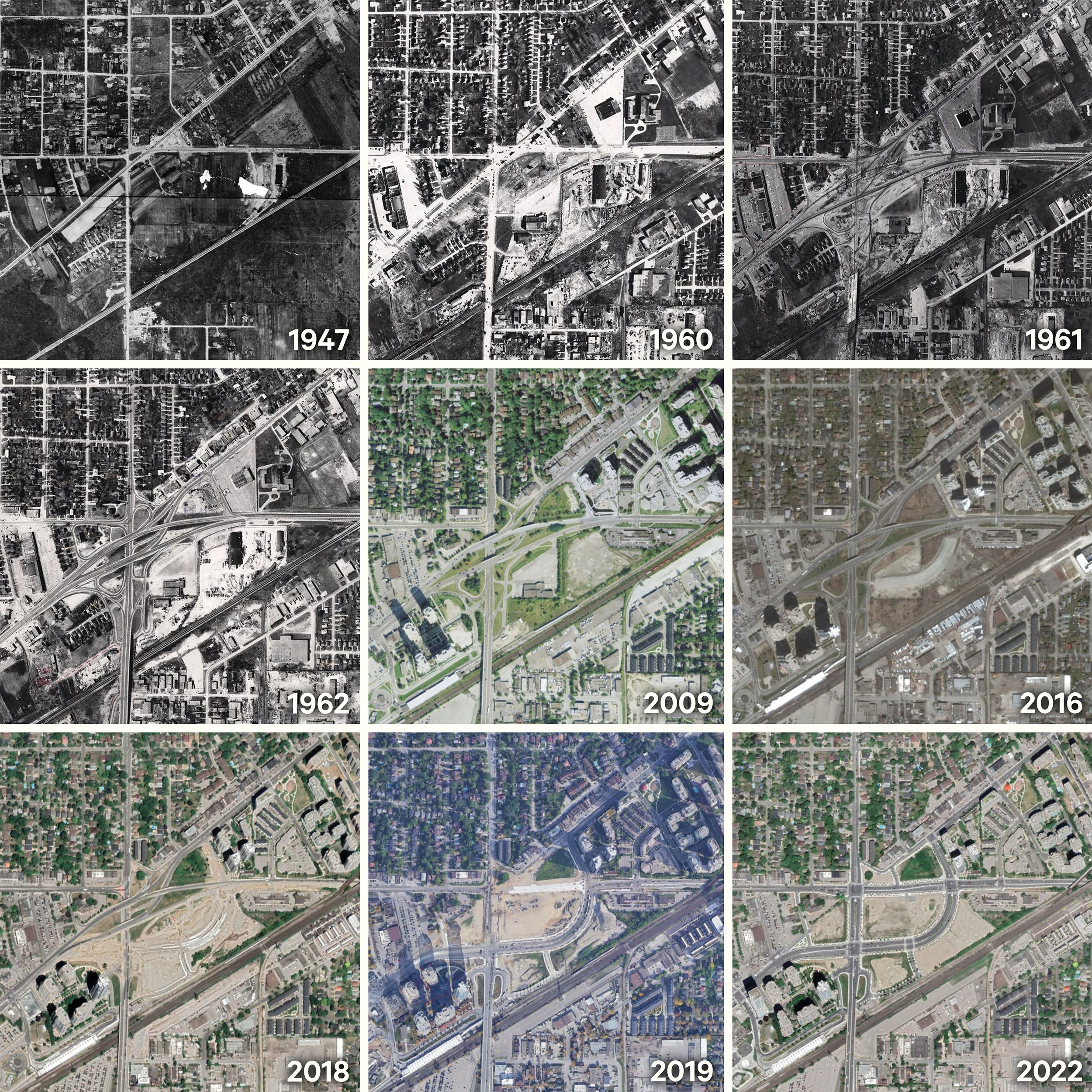
We designed a coordinated network that forms the framework for a new urban centre. Our approach created reconstructed streets, multi-use corridors, and a necklace of modest parkettes that establish the lattice structure for future development. The project freed 1.75 acres for new park spaces and 15.5 acres for mixed-use developments, proving that thoughtful infrastructure can unlock tremendous community value.
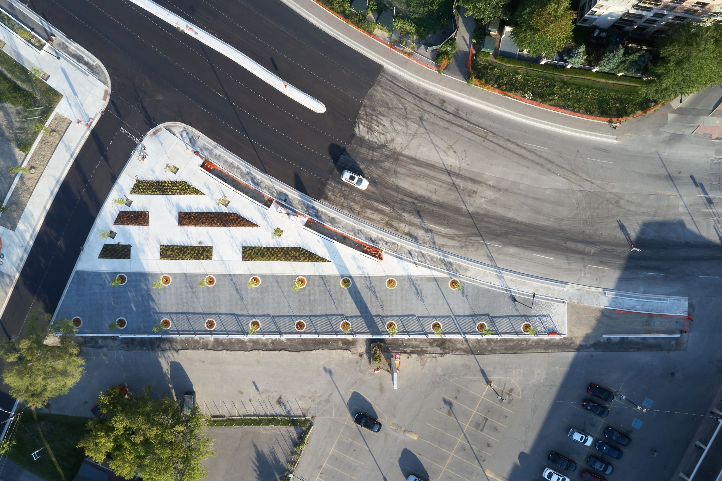
Innovative systems support both immediate function and long-term urban forest growth. We invested in silva cell and stormwater retention systems that minimize impacts on urban infrastructure while supporting 526 new trees of various species, each street planned with distinct character. Thousands of native, drought-tolerant plantings and catch basin filtration systems create resilient landscapes on a site once known as the definition of "concrete jungle."
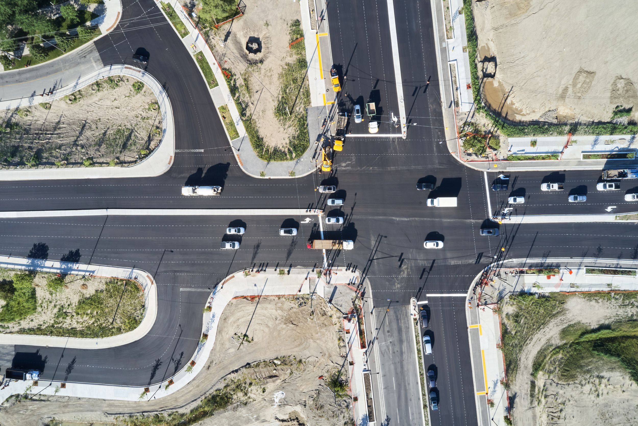
The project includes 2,300 metres of completely separated bike lanes, 144 new bike rings, special pavement markings for safe coexistence of all users, and public boulevards with patio spaces and public art opportunities. Underground utilities and comprehensive streetscape improvements support both daily function and community animation.
Located mid-way between Toronto's international airport and downtown, the improved connections to the expanded Kipling Station create a true regional transit hub. The rejuvenated space encourages all modes of transportation while fostering the activity and animation essential to vibrant urban life.