Durham Meadoway Visioning Study
AIA Canada Society, Design Award, 2024
Azure, AZ Awards, 2025
Durham Meadoway Visioning Study
AIA Canada Society, Design Award, 2024
Azure, AZ Awards, 2025
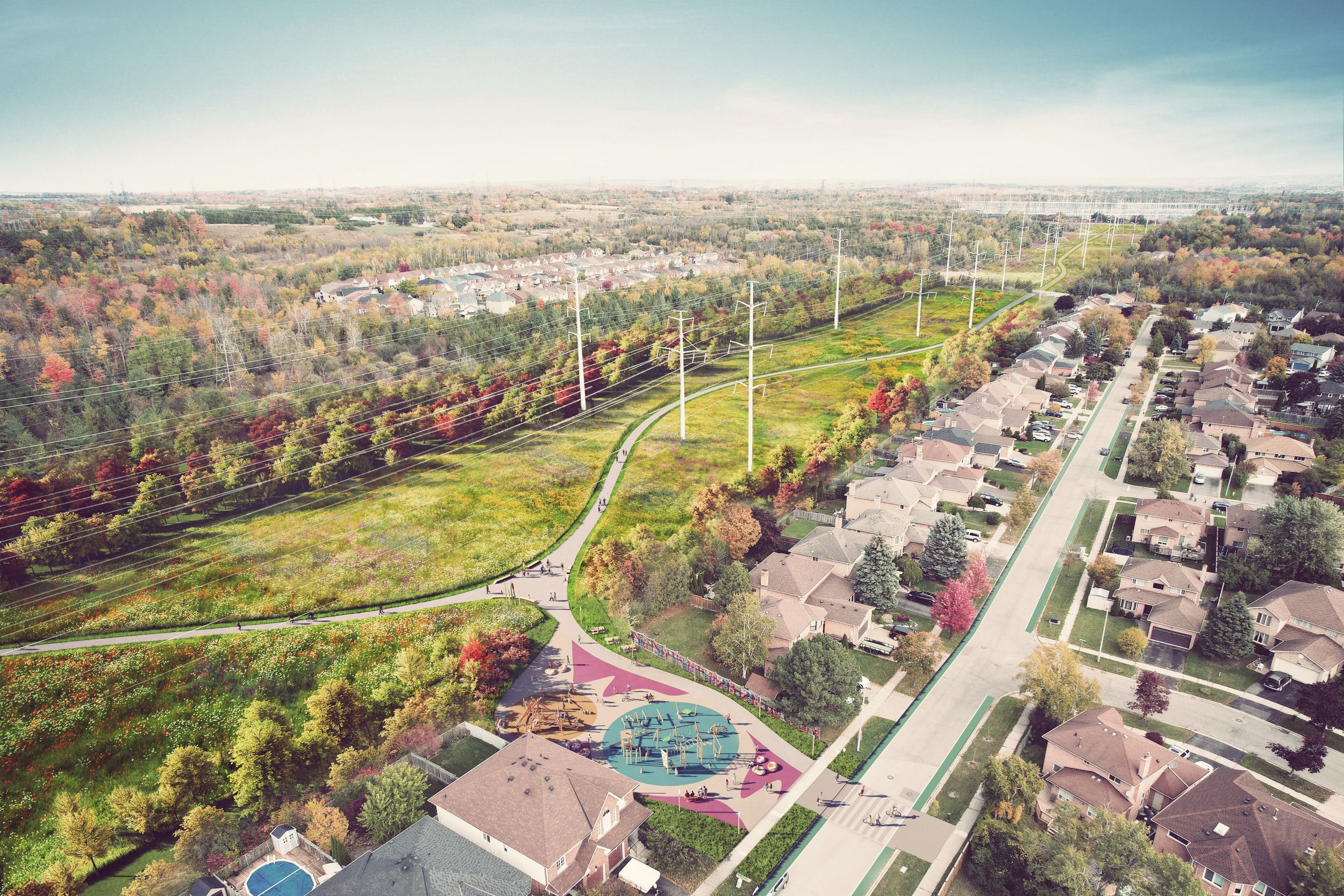
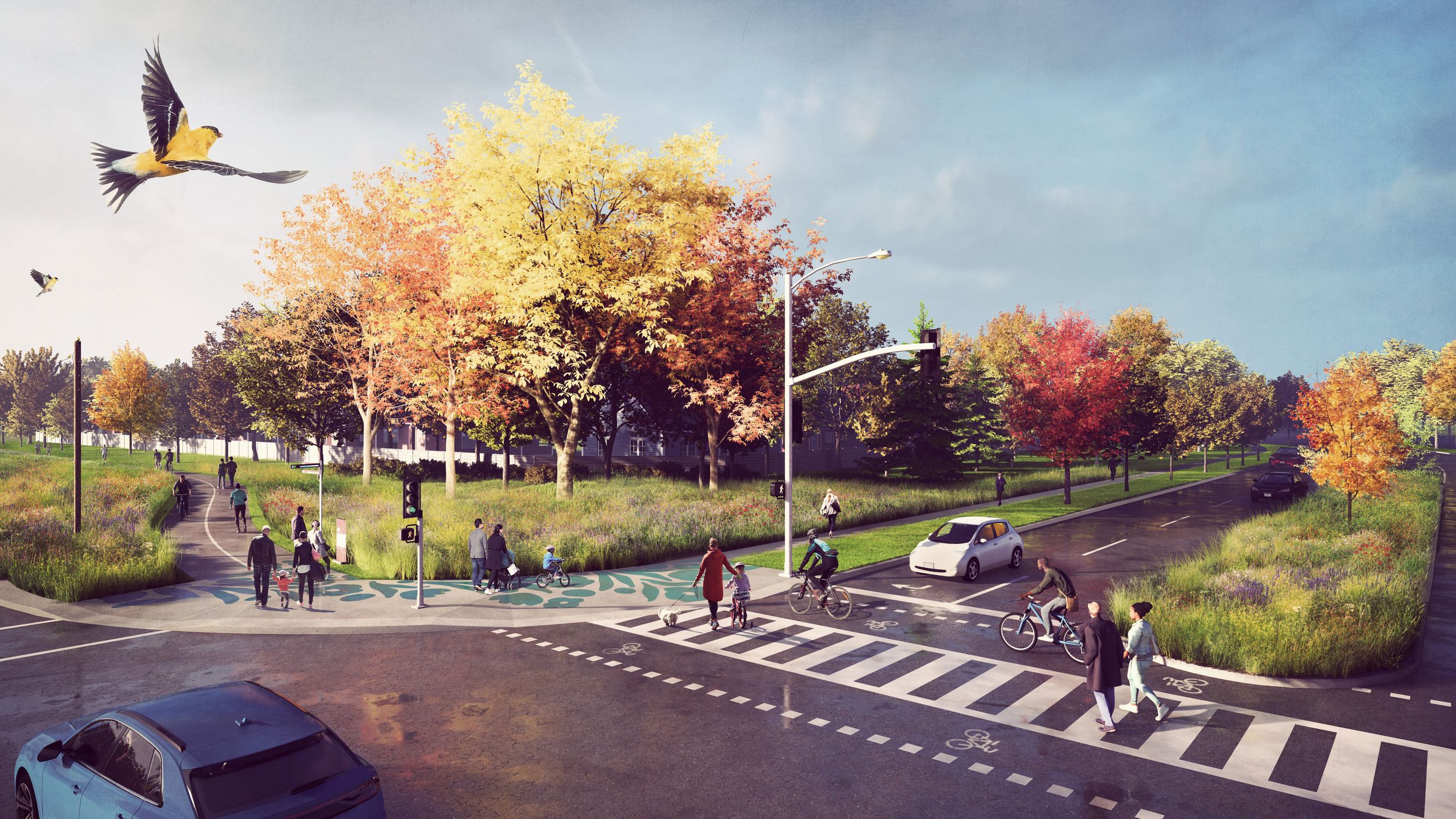
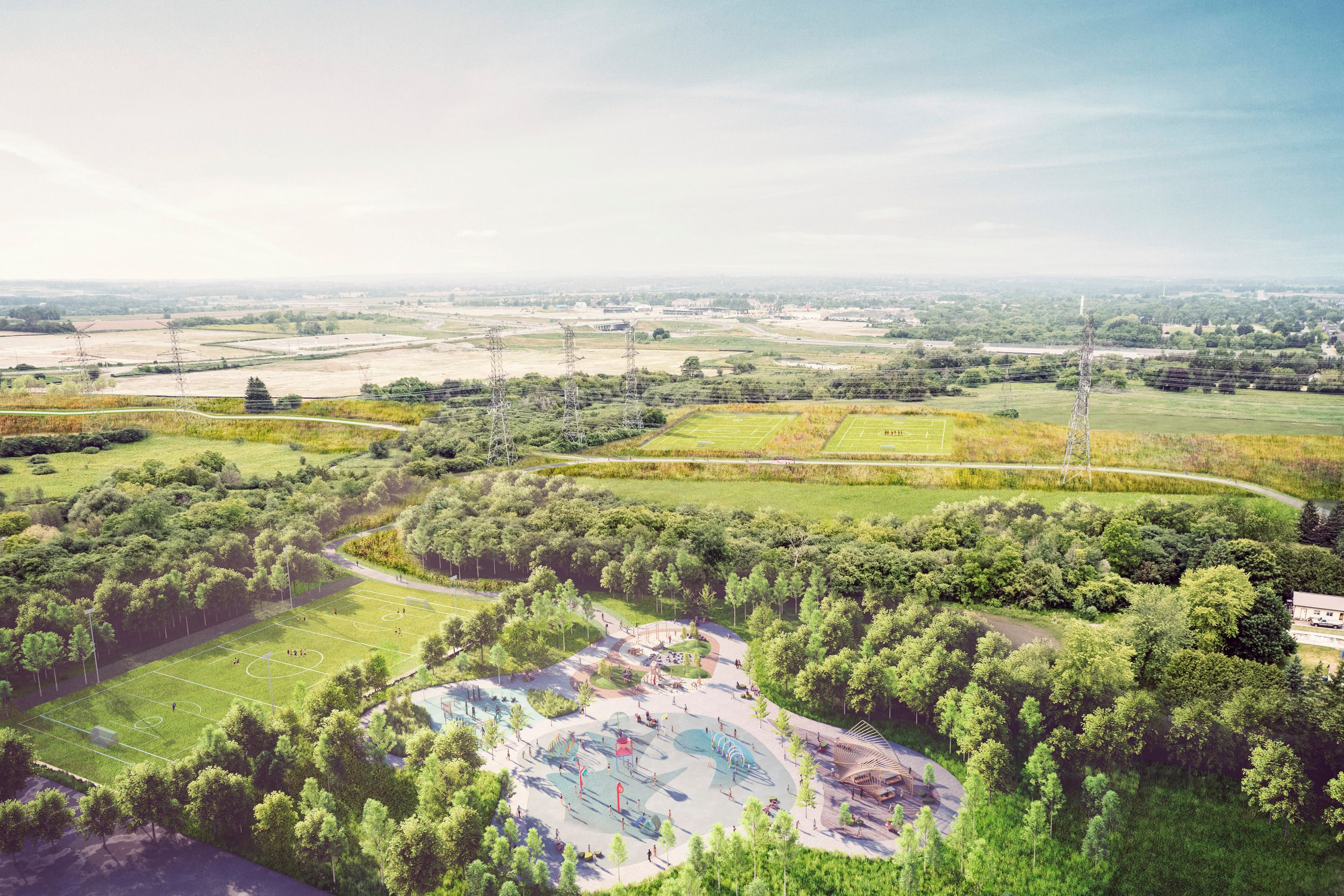
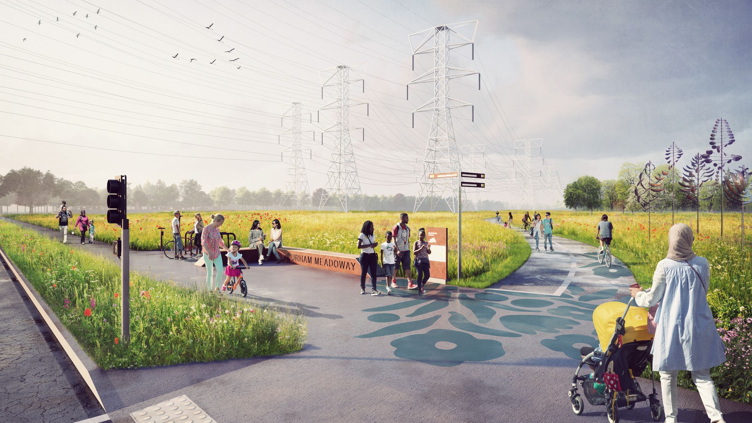
The Durham Meadoway offers a once-in-a-generation opportunity to rethink how we use essential infrastructure. Instead of treating the hydro corridor as single-purpose land, we envision it serving multiple functions while still delivering power to the region. Our approach transforms this 27-kilometre stretch into an active transportation route and linear park, connecting existing trails and parks, including the GTA Trail Network and Rouge National Urban Park. Once complete, people will be able to walk, jog, or bike from Oshawa to downtown Toronto - while staying immersed in nature.
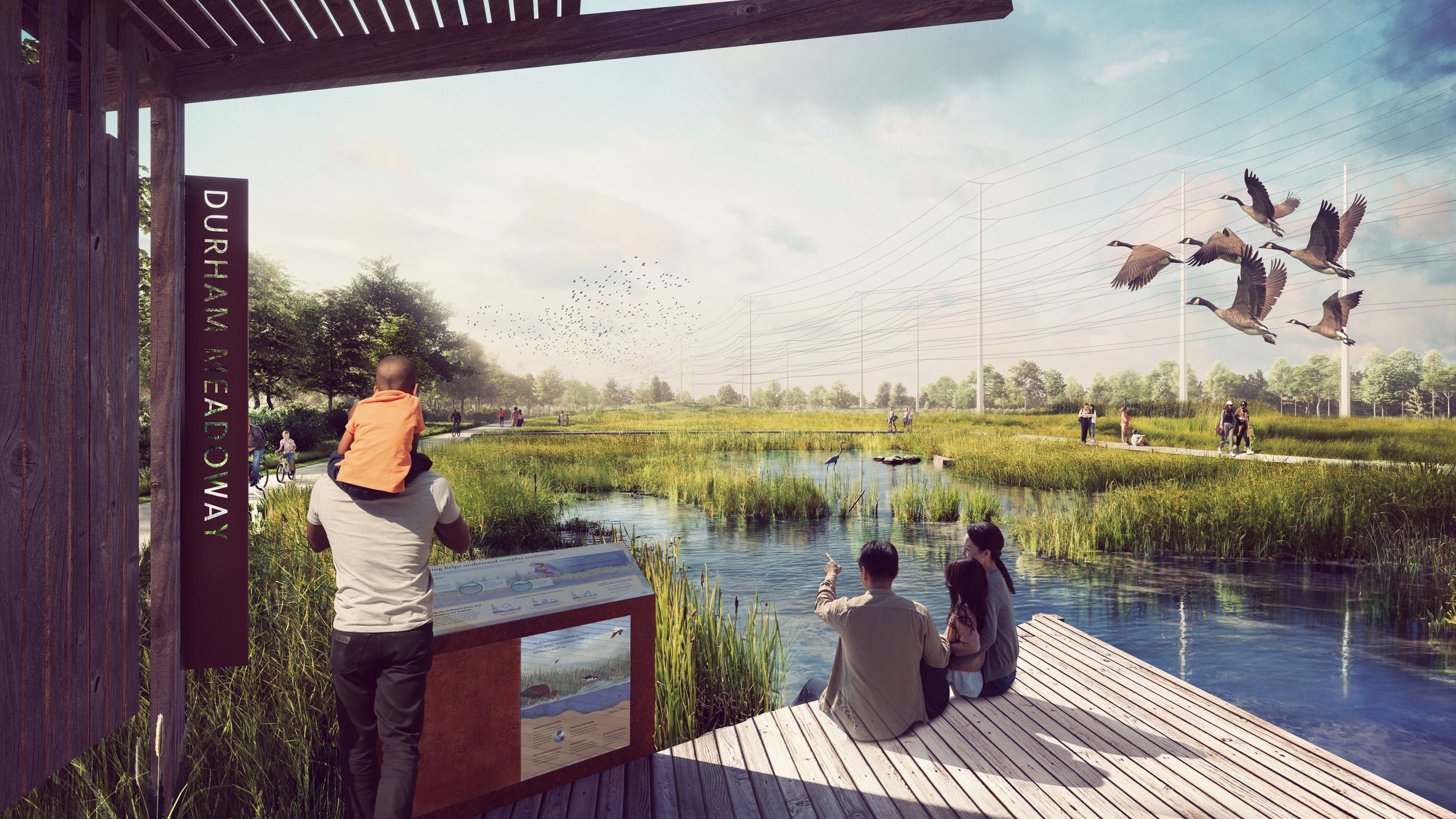
Through extensive engagement with municipalities, agencies, Indigenous Communities, and residents, we developed a vision that celebrates Durham's rich diversity. The public realm provides opportunities for cultural expression that honors First Nations, Inuit, and Métis peoples alongside settlers and new immigrants. Community programming creates gathering spaces for markets, festivals, and everyday social connection, while community gardens and interpretive experiences inspire environmental stewardship.
The overwhelming public response during engagement confirmed our confidence in the project's potential, with the most frequent question being, "When can it be built?"
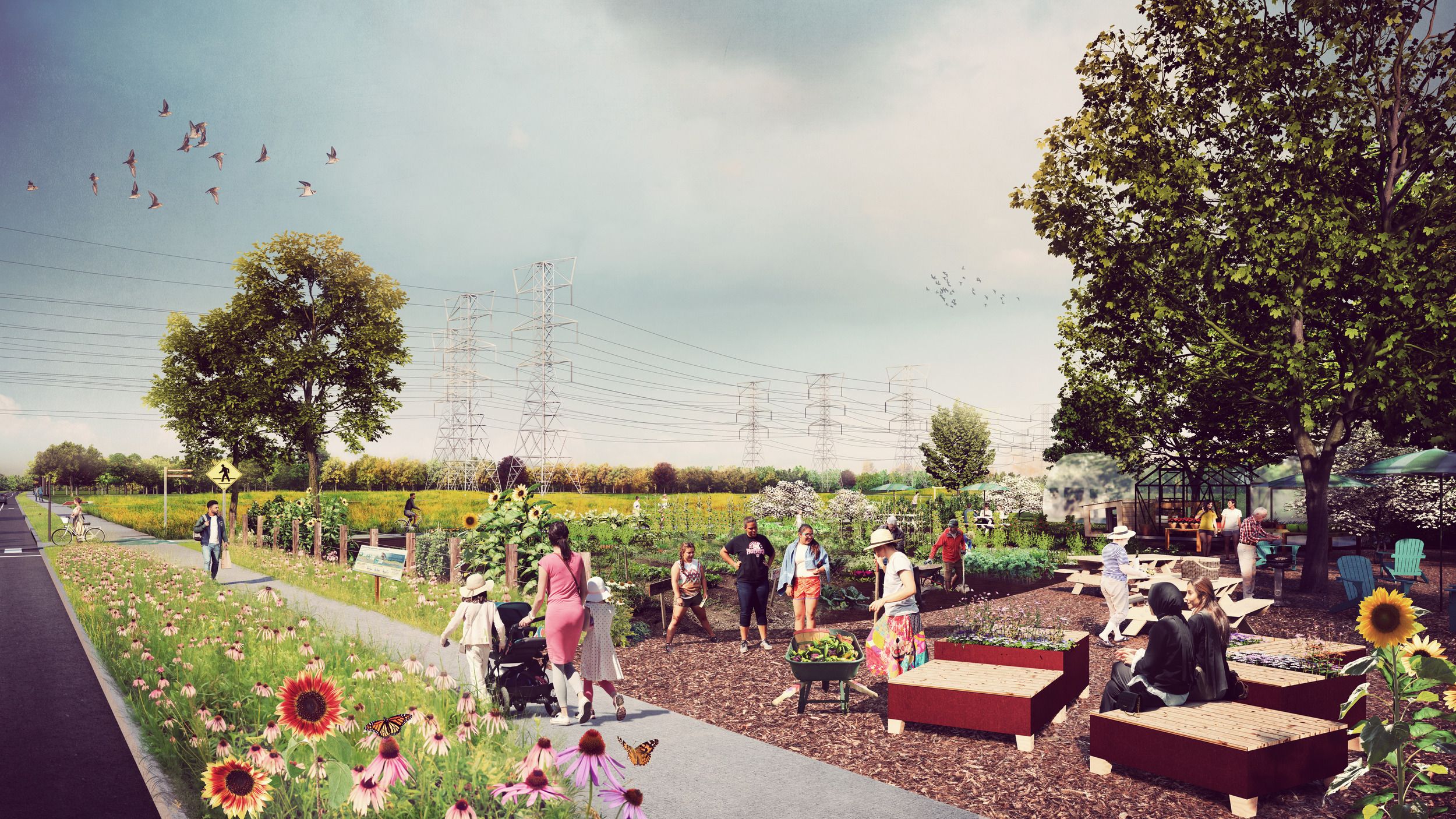
The transmission corridor's inability to support large trees becomes an asset when reimagined as meadow habitat. We designed the landscape to support pollinators, birds, mammals, and other wildlife through native grasses, wildflowers, and plants that thrive beneath power lines. This approach creates crucial biodiversity pathways that connect fragmented habitats across the region while providing educational opportunities for passive learning about local ecosystems. The result is infrastructure that actively regenerates the environment rather than simply occupying it.
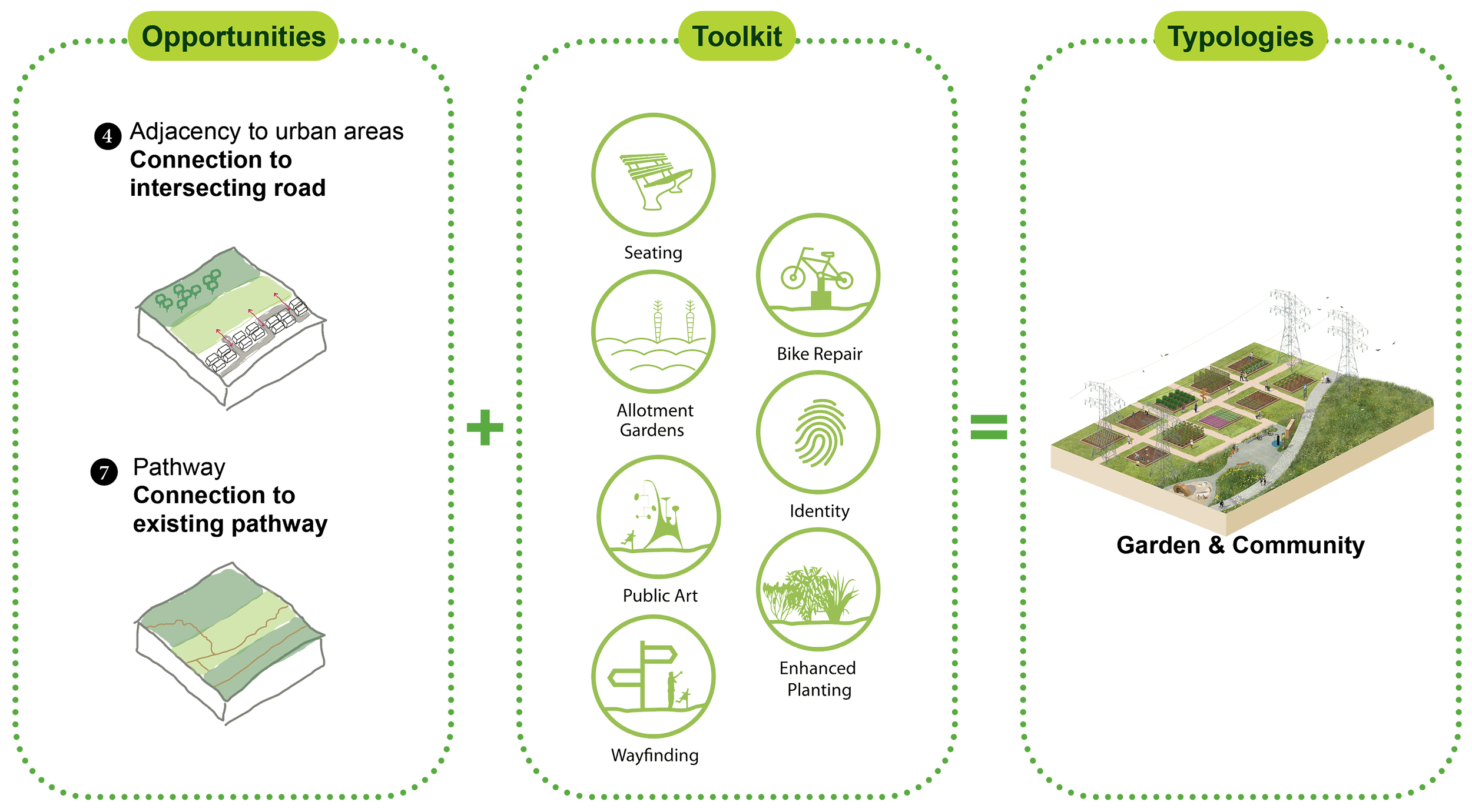
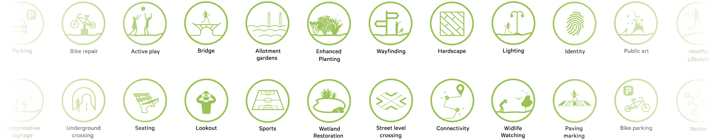
Our visioning study creates a comprehensive toolkit of amenities and programming that can be implemented flexibly along the route based on local community context and opportunities. Four distinct typologies—Active Play, Nature Space, Garden & Community, and Road Crossing—provide frameworks for creating special destinations while maintaining trail continuity. The study addresses practical considerations from route alignment and road crossings to regulatory approvals and phasing strategies, ensuring the vision can evolve from aspiration to reality. With Durham Regional Council's endorsement in August 2024, Stage 1 is complete, providing the foundation for technical studies, design work, and construction that will bring this transformative vision to life.